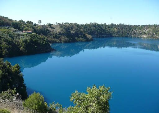
Driving back into town we walked down into the Cave Garden right in the centre of town next to the Library and Arts Centre. This sinkhole was the original source of water for the early settlers and during winter the stormwater runoff makes a spectacular waterfall down into the Cave where it eventually enters the underground water system which possibly feeds into the Blue Lake. We also visited the Umpherston Sinkhole which was originally a cave before the roof fell in to the cave floor and created terraces which have now been landscaped into a beautiful sunken garden. Mt Gambier actually sits over a huge complex of underground limestone caves and is pockmarked with sinkholes and lakes.
The following day we drove south to Port MacDonnell the self proclaimed “Southern Rock Lobster Capital of Australia”. The first thing we noticed was how incredibly flat the whole area was – barely above sea level – with extensive breakwaters forming a safe harbour for the lobster fishing fleet. We walked around the ruins of the original lighthouse erected above the limestone cliffs at Cape Northumberland on the western side of town. However it was abandoned when the cliffs began to fall into the sea and a replacement lighthouse was built a little further inland on safer ground. There were some interesting rock formations formed by the action of the waves and fairy penguins come ashore at dusk.
On returning to Mt Gambier we visited the "Lady Nelson" Discovery Centre which houses a life-size replica of HMS Lady Nelson captained by Lieutenant Grant when it became the first vessel to sail eastward through Bass Strait. His first sighting of the Australian mainland were two mountains which he named Mt Gambier and Mt Schank to the south. The museum also held displays on the geology of the region as well as the history of the pastoral, forestry and tourism industries.
No comments:
Post a Comment